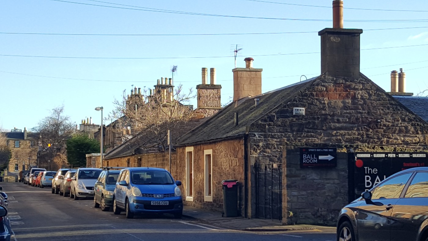
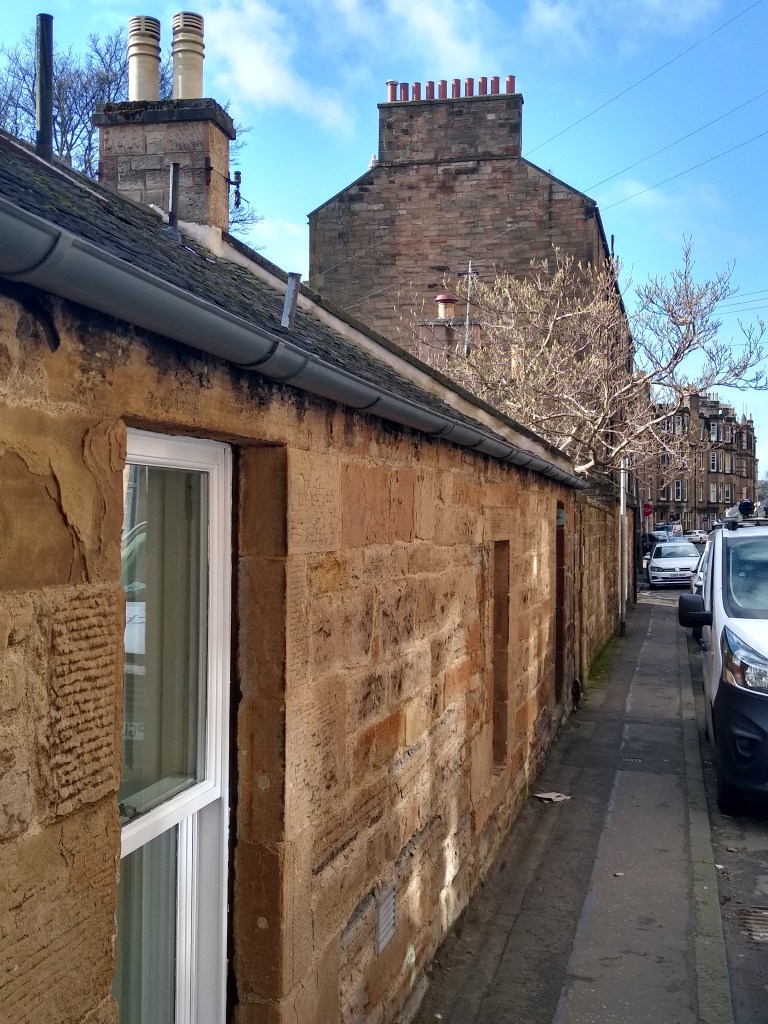
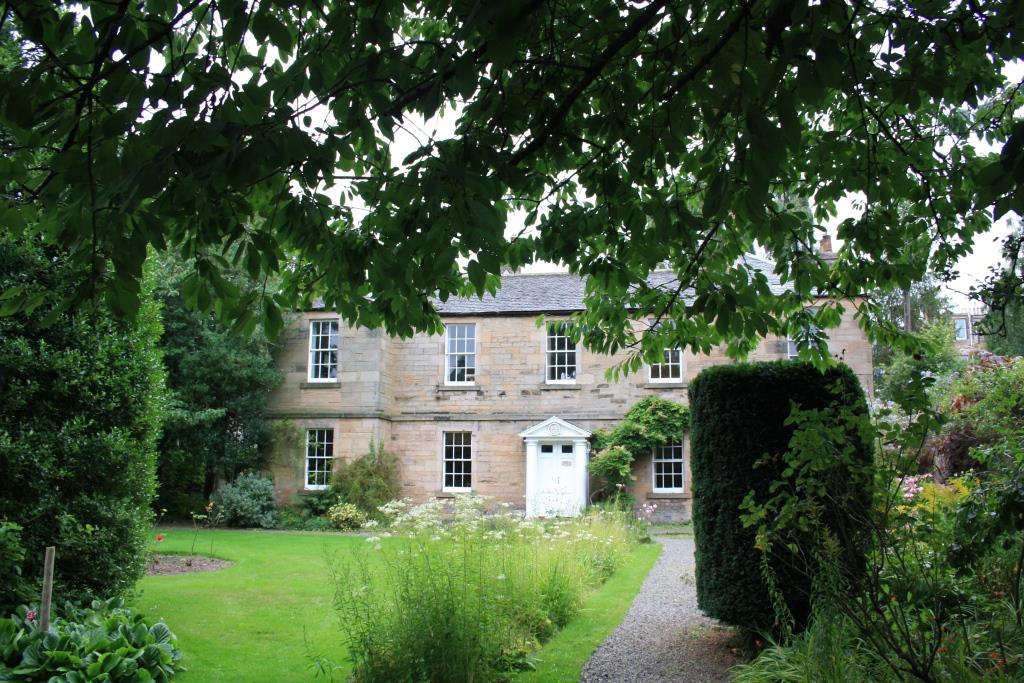
A “row of thatched cottages, a line of trees and a blacksmith’s forge” is a much quoted description of Old Morningside (though the original attribution is unknown to me).
Morningside was a little rural village on the road south from Edinburgh and at the limits of the burgh’s lands. Around it, before 1800, were farms, and a couple of castles or grand seats, and beyond it to the south lay (and still lie, beyond the suburbs) wilder rural lands and hills that attract snow, shopping warehouses and outdoorsy activities. In the nineteenth century came two waves of transformation. First came the large villas, estates and institutions, parcelling up the land. Then down the roads and later into the fields came the smaller houses, terraces, and tenements, new roads and trams, with Edinburgh’s peripheral South Circular Railway appearing in 1884. By 1900, the area’s mixter-maxter of housing styles and road patterns were in place.
That mixed character still exists today (though the seriously large private dwellings and industrial or non-retail commercial premises are in decline). The variety, and not just the mix of “traditional” stone and peaceful greenery, give the area its charm. It is one of the central districts of Edinburgh that still has a character all its own.
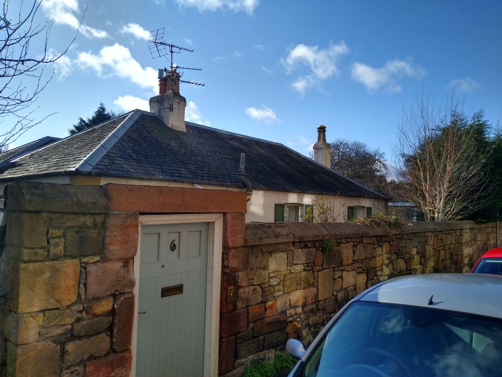
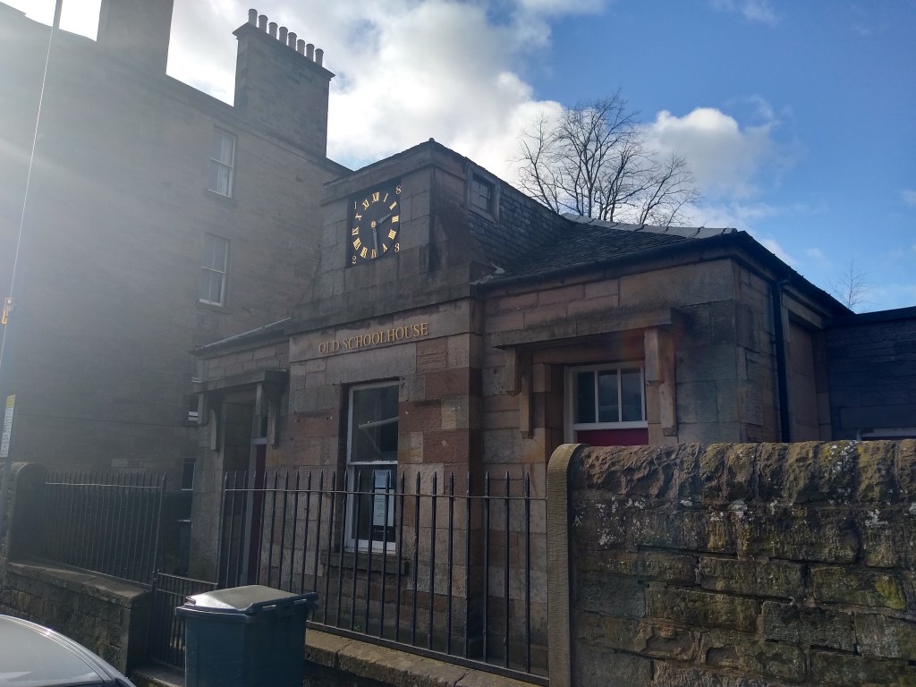
Elsewhere on Jordan Lane are a group of B-listed cottages, 14, 15 & 16. According to BritishListedBuildings, No 14 was “the home of David Ramsay Hay, the interior decorator and creator of the interiors at Abbotsford, Sir Walter Scott’s house. Hay joined No 14 with the adjoining No 15 and built the conservatory (circa 1830).” Other interesting alterations are described.

I’m not going to delve too deeply into the fascinating history of Morningside and Canaan, in Edinburgh, but I want to paint the general scene, highlighting the old cottages. This post is background, something to accompany my very specific house-history, of a Morningside tenement flat.
I highly recommend a wonderful book: Morningside by Charles J Smith (1992). A book-length treatment of the whole area is absolutely needed. It is richly researched and full of detail: genuinely interesting detail, at that. I bought a copy after we had moved from a brief stay in Bruntsfield just down the hill to Woodburn Terrace in 1996. I skimmed it, and remembered parts of it vaguely thereafter. Going back to it for my house-history, I was ready to enjoy all the detail… and of course found giant gaps just where I wanted to know more.

I’m going to pick out a couple of elements from the book that caught my fancy while researching our own flat and the owners of the land just prior to its building 1878-1881. And I’m posting photos found on the internet and posted to discussion groups, as well as my own, so if someone knows the copyright owner or photographer or official archive label, please let me know so I can add the information. The temptation is to reproduce everything (no, read the book!) or nod to all the stories and people (no, too many, and I guess wikipedia is the place for all the highlights).
Elsewhere I discuss the creation of our street, and devote a couple of posts to local resident Lt-Col. Donald Robert MacGregor MP (who only gets one sentence in Smith’s 1992 book). He was MP for Leith, owner of Woodburn House, merchant, steamship entrepreneur, and officer in the Midlothian Rifle Volunteers. I’m also telling the story of his ship, the SS Leith. Here, though, I’ve combined some material from Smith’s book and other sources. The more original research is reported in the other blogs.
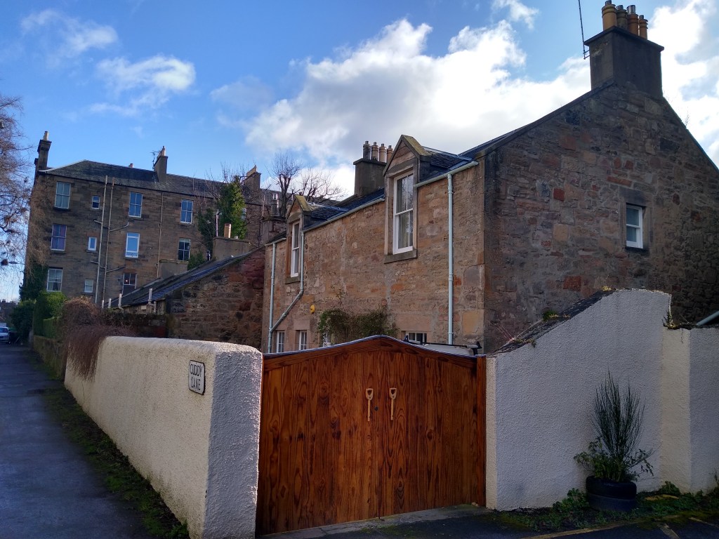
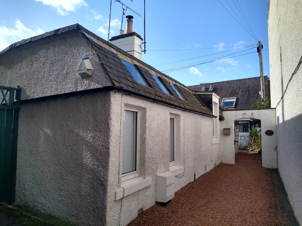
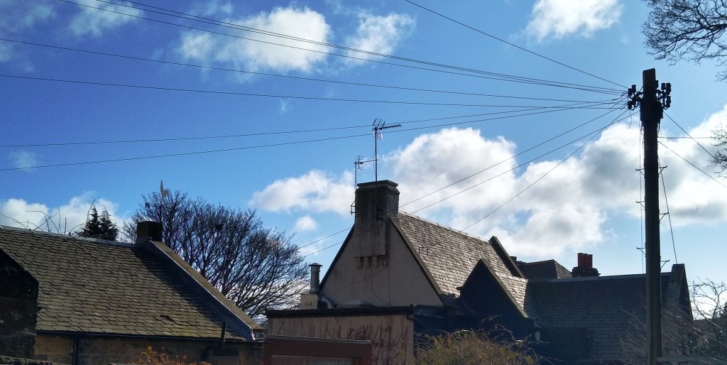
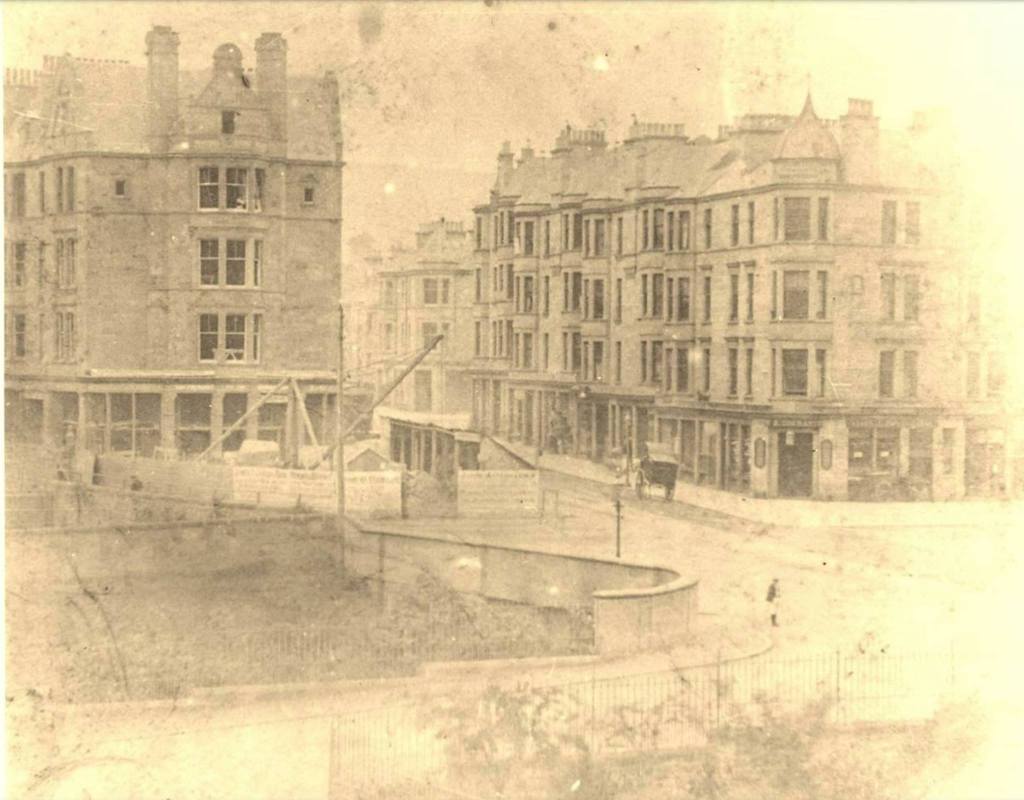
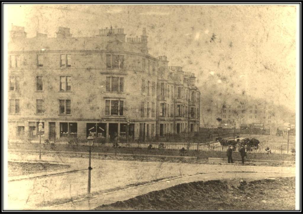
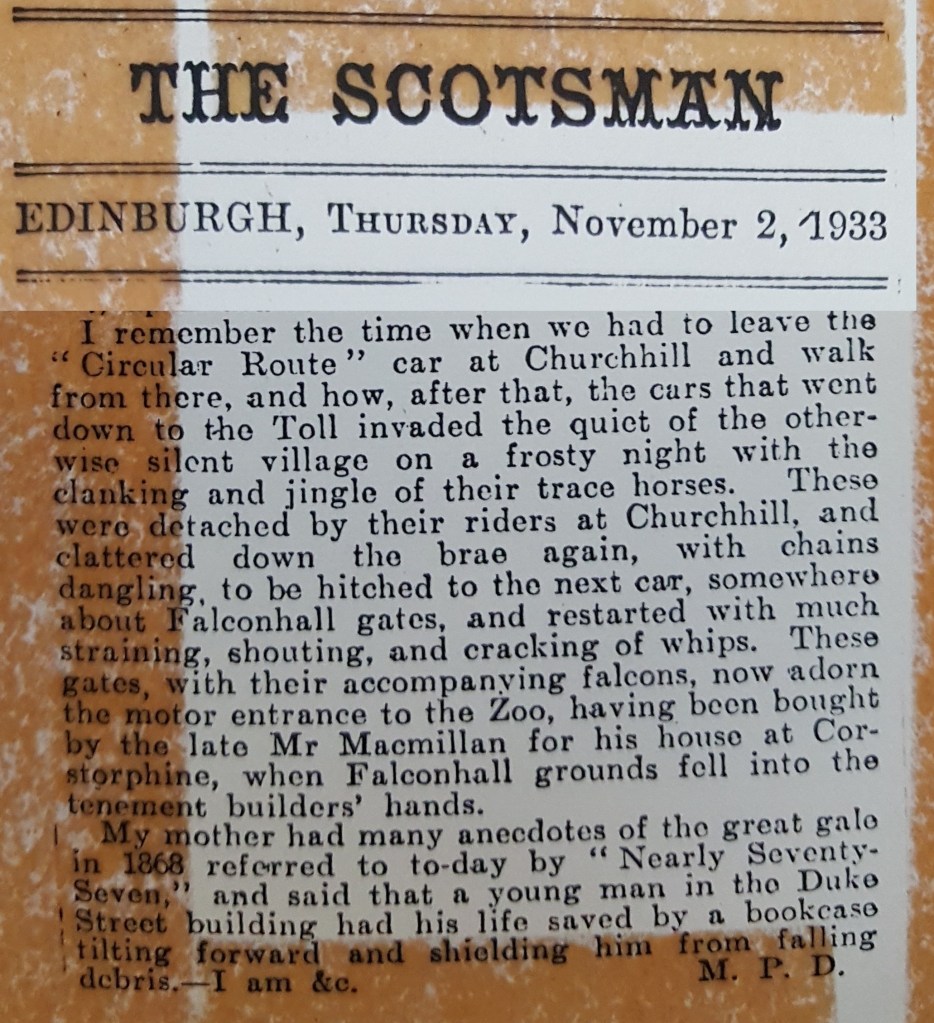
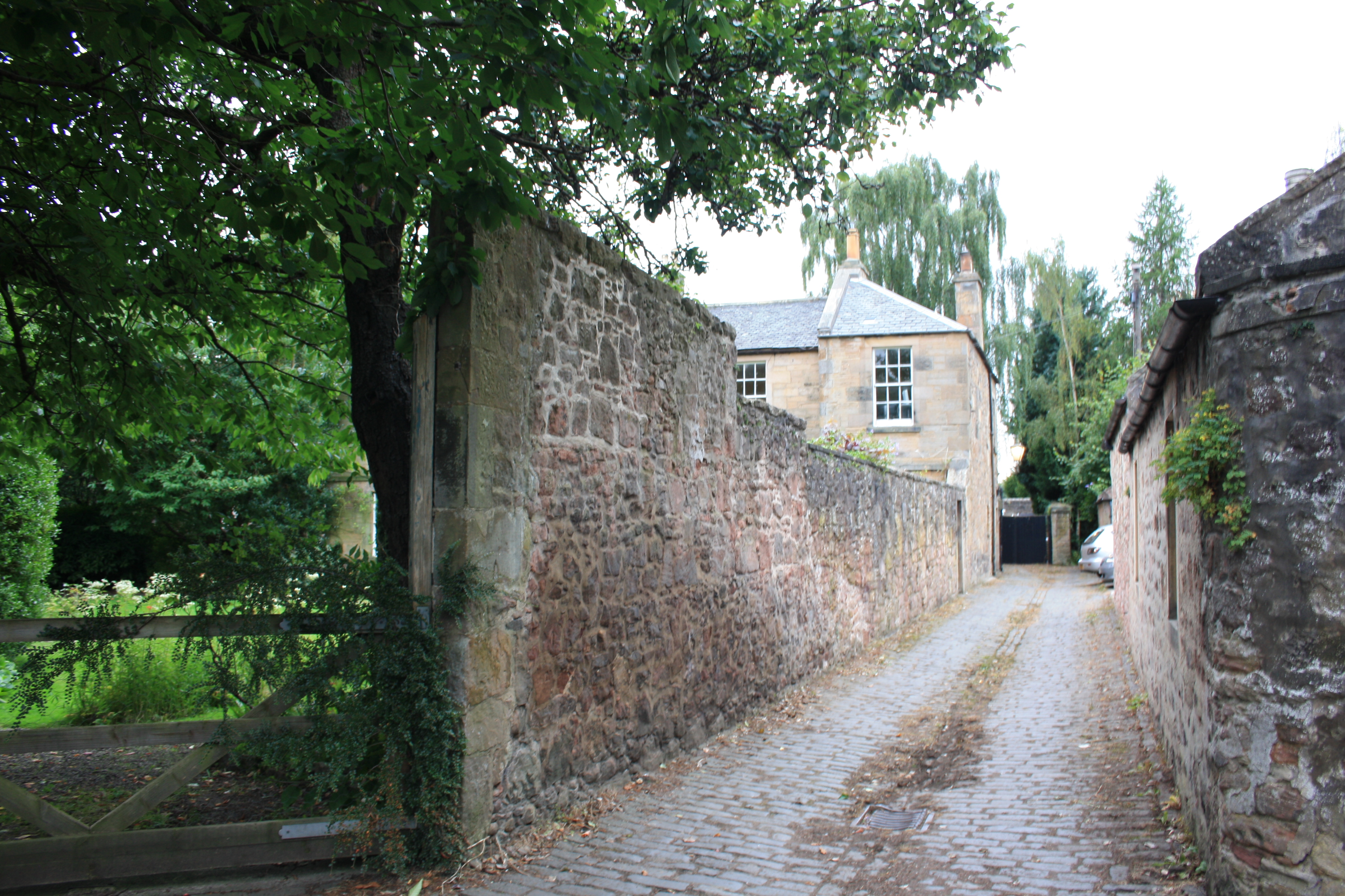
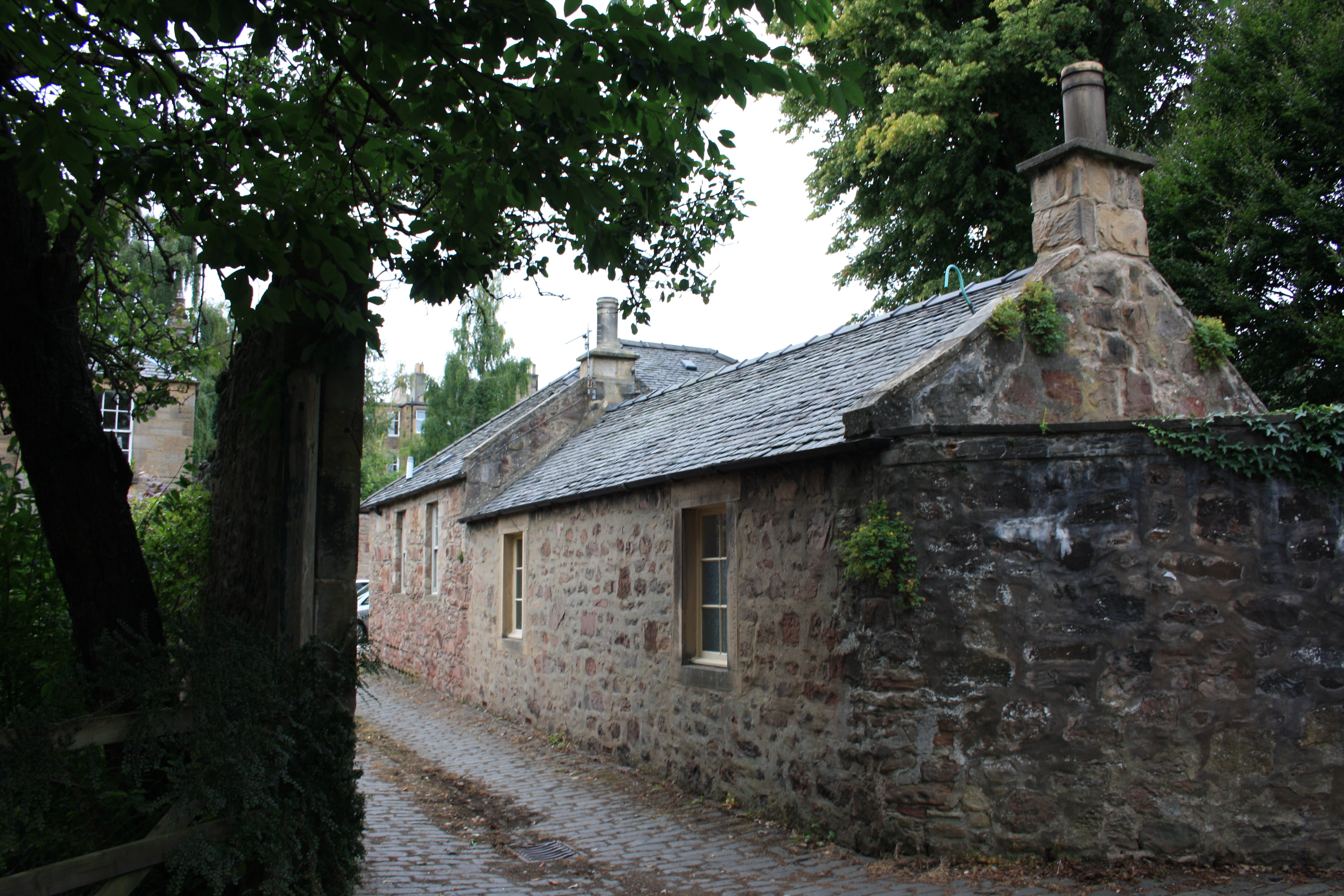
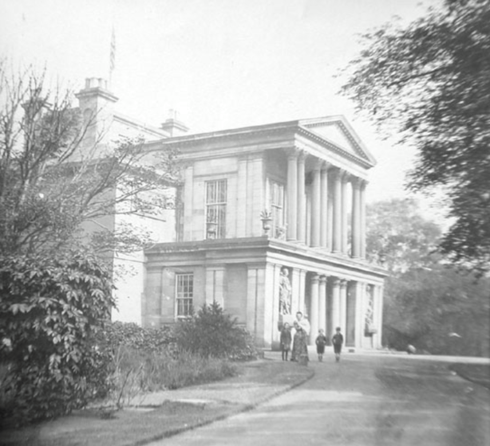
The photographs above focus on the pre-urban, village stage. The grand mansions co-existed with single storey traditional cottages. It was in the third and especially the fourth quarter of the 19th C. the tenement builders appeared in force, and the area became truly urban.
I’ve previously written about Morningside and Greenbank around 1914, and will do again: it so happens my Great Aunts Ebeth and her sister Mabel Logan both lived nearby in the early to mid 20th century, and of course their children (my father’s cousins) too. My great grandfather James Scobbie used to visit Mabel in the 1940s even as he approached his 90th year, and died in Edinburgh on one such visit.

Lands of Canaan
The New Statistical Account of Scotland for the City of Edinburgh (1845) mentions Canaan under the description of the city’s southern moorland (the Burgh muir). It notes that around 1600, Edinburgh old town was small, with densely populated buildings with much wooden construction. It explains that around 1500 “the whole of the Borough Moor, or myre, to the south of the city, was covered with wood; and, in order to dispose of this to the best advantage, an order of the Council enacted that those citizens who would purchase as much of the wood as was sufficient to make a new front to their houses, were at liberty to extend the same, seven feet farther into the street. This offer appears to have been eagerly accepted; and the consequence was the clearing of the wooded moor, and the narrowing of the principal street by wooden projections…[cantilevered out on the upper floors of buildings in the Old Town].”
Morningside was removed from all this activity, being out of sight: the village was on the south facing slope below Churchhill.
In the plague of 1585, Edinburgh’s sick and dying were “cared for” in a manner: they were quarantined by being expelled from the city, to the edge of its lands, at the Jordan Burn, near the farm of Littil Egypt. Documents relating to this sad set of refugees, and the brewing needed for them, provide some of the earlier references to place-names in the area.

The Jordan Burn rises at the southern base of Craighouse Hill and runs east just south of what is now the Royal Edinburgh Hospital until, in Newington it “changes its name to that of Pow Burn & finally unites with Braid Burn near Duddingston Loch” (OS Name Books at Scotland’s Places). After Duddingston, it becomes the Figgate Burn, entering the sea at Portobello. Perhaps the otters recently seen playing in the Union Canal swam up the burn before nipping across to the canal?

The plague is by the way said to be the cause of the lumpy landscape of Bruntsfield Links (mass graves)… but I am not so sure. The recent and continuing proliferation of mental and physical health institutions for treatment and convalescence does reflect on Morningside’s one-time location at the edge of things. But it’s not really an “edgy” area any more.
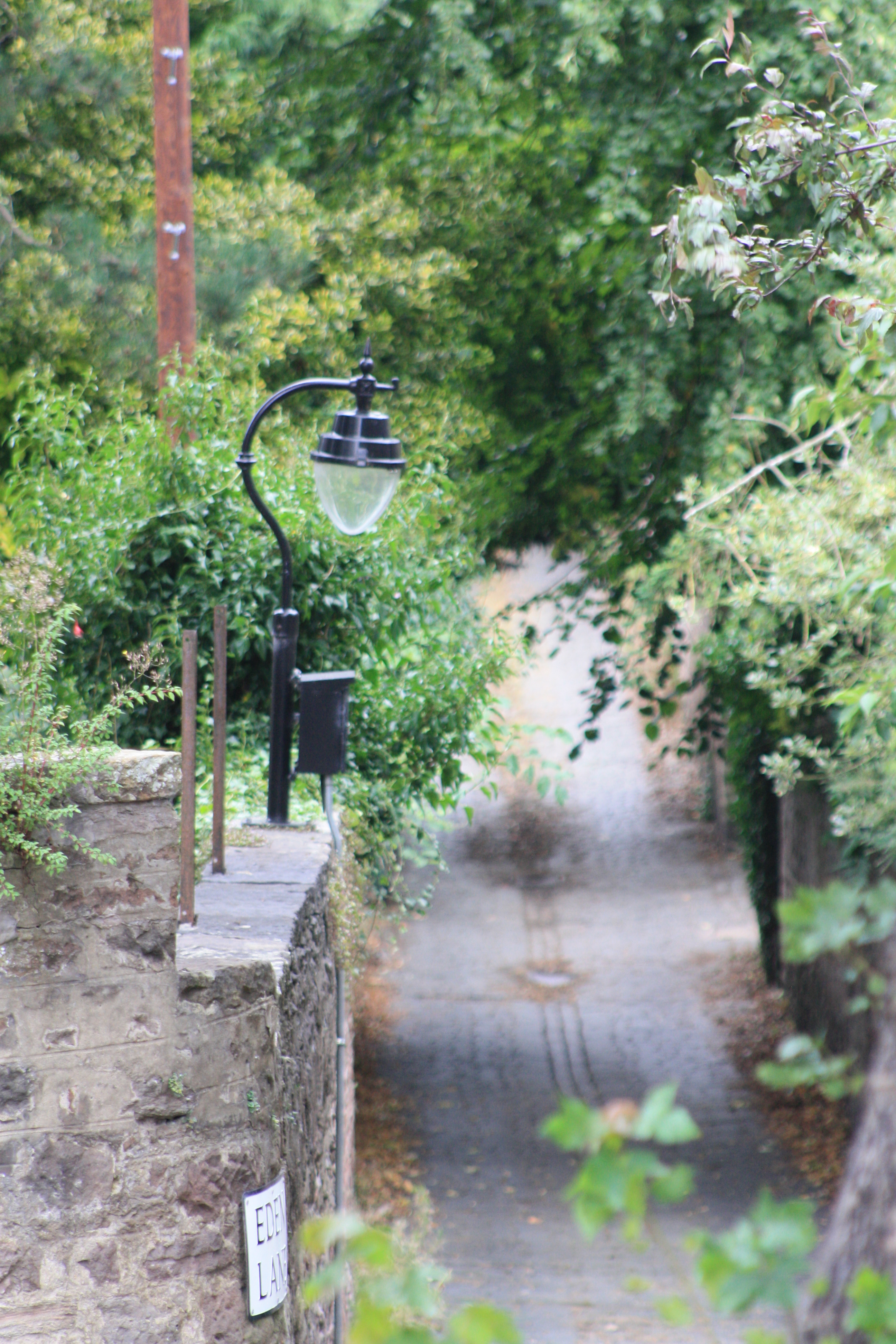

The Slideshow has images of Eden Lane, running south from Newbattle Terrace towards Woodburn Terrace. It is an otherworldly cul-de-sac with cute cottages and villas, and “Harmony House” which was the home of Rev. James MacGregor (1829-1894), who was professor of systematic theology at the Free Kirk’s New College Edinburgh, and emigrated to New Zealand in 1881 (see notes) to escape tuberculosis. He was the brother of (Dr?) Margaret Morris (b.1807) and she was a grandmother of Mary Morris Walker, who married William David Henderson Stevenson in 1911 after which event I can call her my great aunt. More notably, Margaret Morris was a great great grandmother of the physicist Stephen Hawking.
Braid Hills
So for much of its upper reaches, the Jordan Burn marks a natural boundary at a low-point in the landscape. Morningside village was on the main road from Edinburgh Castle to the south (west) and lay just before the road forded (then bridged, as now) the burn, at the Briggs o’ Braid (just north of Morningside Cross). Southwards, the road (following a Roman line) leads upwards to a pass through the Braid Hills (just exceeding 200m), the first seriously inhospitable area to the south of Edinburgh. These hills remain wild, gorse-covered, and the home to the most magnificent council golf-course imaginable, near the medieval Liberton Tower. Cromwell camped nearby in 1650 before his army occupied Edinburgh.
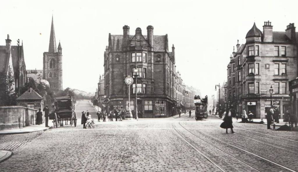
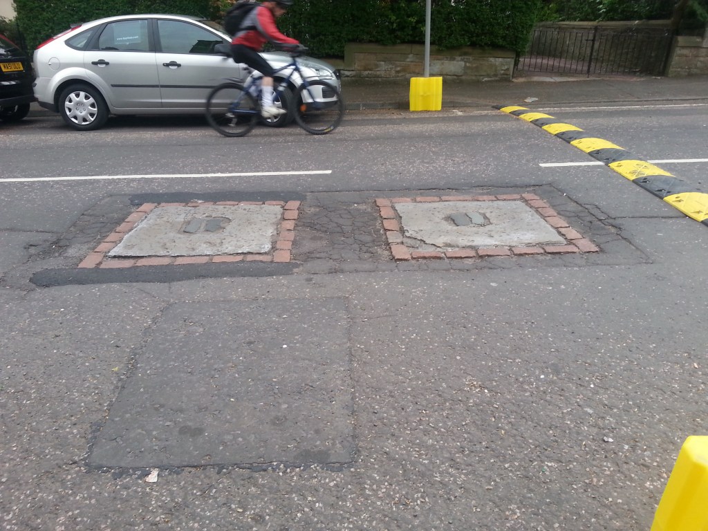
The area really was at the edge of things, even as late as 1815. Just as the road leads south from Morningside Cross, 5 minutes walk from our flat, you can find the Hanging Stanes, embedded in the surface of Braid Road (at NT 2451 7061). They formed the foundation of a scaffold specifically erected for the hanging of Thomas Kelly and Henry O’Neill on 25th January 1815, thought to be the last public execution for highway robbery in Scotland. The hanging took place at the scene of the crime.
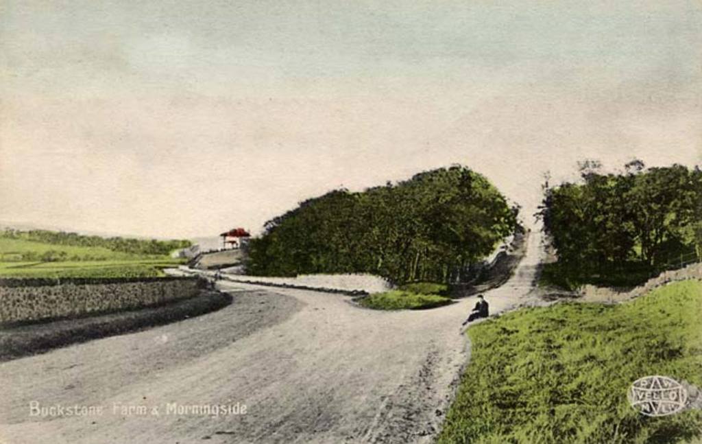
If, 85 years later from the time of this public execution you had continued south, crested the road at Braid Hill, and descended to the road junction with the new main southern road, then turned – this is the view you would have seen. The area became suburbs between 1918 and 1939. Recall “up the auld and doon the new” mentioned above.
Grand Canaan
In his wonderful 1992 book Morningside, Charles J Smith says “the feuing plan of Canaan for 1803 [by William Mosman] indicates a division into 22 lots. Many of the original purchasers of these built villas in this pleasant rural distinct, but there were several provisos, one being that villas were not to cost not less than £300 to build (in the early nineteenth century this was a fairly substantial sum).” (page 113). Mosman’s feus demanded that new owners “could not establish any trade or manufacture a nuisance”.
It would be nice to get more information on these owners of Canaan referred to by (Mosman and Greenlaw), but for now all I’ve found quickly via the internet is as follows, which is additionally interesting because it refers to the ancient owners disentailing land (their feu rights?) as late as 1908 and 1916 (Bryce’s The Burgh Muir of Edinburgh from the Records).

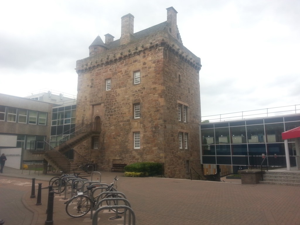
Perhaps this focus on not being a nuisance (“Oh, How Morningside!“) was because William Mosman had, in 1797, feued land nearby to Dr Thomas Steele to build a small magnesia factory “so far as the same shall not be a nuisance to the neighbourhood”. This was in the location now named Steel’s Place, in the heart of the traditional village, near the blacksmith’s etc. Around 1800 it must have been clear that the lands of Canaan, which had been wooded moor interspersed with the occasional ancient seat (cf. nearby Merchiston Castle richly described at Castles of Scotland – the keep dating back to the 1450s and home of John Napier (1550-1617), 8th Laird of Merchiston, the inventor of logarithms in mathematics) was ready to transform into some sort of upper middle-class rural idyll, where place names like Eden might conjour paradise, and memories of plague and civil war were presumably fading away as the British Empire seemed to be the only future worth considering, just as Sir Walter Scott romanticised the past. (Scott is of course memorialised in a spectacular fashion on Princes St. thanks to the monument desgned by the inspirational and tragic figure of George Meikle Kemp, who is recorded living at Ainslie Cottage in Jordan Bank at the time of his death. And recall the mention of 14 Jordan Lane, where David Ramsay Hay, author of The Laws of Harmonious Colouring Adapted to Interior Decorations among others, who designed Abbotsford’s interiors, lived for a time.)
The feuing of Canaan in 1803 with 22 substantial villas in mind was a grand plan that must have grown from the radical social and political changes that had affected Edinburgh during the 1700s: the New Town from 1767, the Age of Enlightenment, the creation of the United Kingdom of Britain and Ireland (1707) and the suppression of actual or potential Jacobite (1715, 1745) and Catholic rebellions (1688 onwards) had transformed Edinburgh’s place in the world. Wars were overseas, money was flooding in. The general population was growing, and also getting richer, but the dawn of the Victorian tenement builders and the transformation of Edinburgh through the proliferation of higher-density but good-quality tenement streets like Woodburn Terrace was still over half a century away.
Rhubarb
Here is an example, of something. Perhaps it illustrates the way Edinburgh used to be, with its intellectual (here, medical) and commercial aspects. It still has those characteristics in, for example, informatics (and though the professors don’t live in quite such grand houses, some of the entrepreneurs do).
People’s diets were terrible. Fresh fruit was bad for you. Meat was a staple. People had dreadful constipation, wind, and acid reflux.
I earlier mentioned a magnesia factory. Magnesia, the chemical, neutralised acid in the stomach, producing copious belching as evidence of the reactions within. But it was hard to swallow the chalky material. A local Morningside resident found a way to make it more palatable, while extending the action to the lower bowel. Thus magnesia became a key component in a medical preparation called Gregory’s Powder.
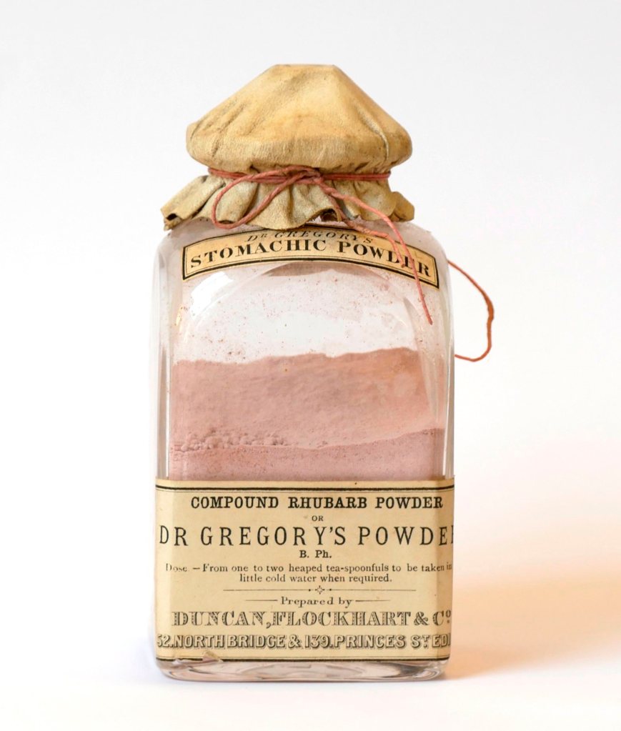
It was developed by the distinguished medical professor Dr James Gregory (1783-1821) who lived at Canaan Lodge, one of these grand new villas. Gregory was very talented, from an influential medical family, and he became extremely rich, in part due to his eponymous laxative and antacid power that mixed magnesia with extracts from ginger, mint and rhubarb.
He was able to collaborate with the local pioneers of rhubarb growing, who had obtained seeds stolen by another distinguished Scottish doctor, the private physician to Czar Peter III, who fled Russia after the Czar was murdered by his wife Catherine the Great. Mounsey’s smuggling helped break the lucrative Romanov monopoly on dried rhubarb, but he lived thereafter in fear of assassination. The etymology of “rhubarb” refers to Russian “Barbarians”, by the way.
The Royal College of Physicians of Edinburgh tweeted the image above from their collection. Their tweet read: Gregory’s Powder, a popular rhubarb laxative concocted in the 18thC by @RCPEdin President James Gregory. Used to treat constipation, sore heads and, in women, absence of menstruation and amongst men excessive ‘self pollution’.
Postscript
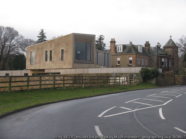
Local building continues, some of it intended to be expensive and bespoke rather than designed primarily for profit or to solve the housing shortage. Looking back to Victorian urban expansion it’s tempting to assume it is easy to combine all the drivers… but I don’t suppose it ever is. Edinburgh has areas of beautiful 19th century consistency, and areas with messy, half-planned melange. Morningside is characterised by both.

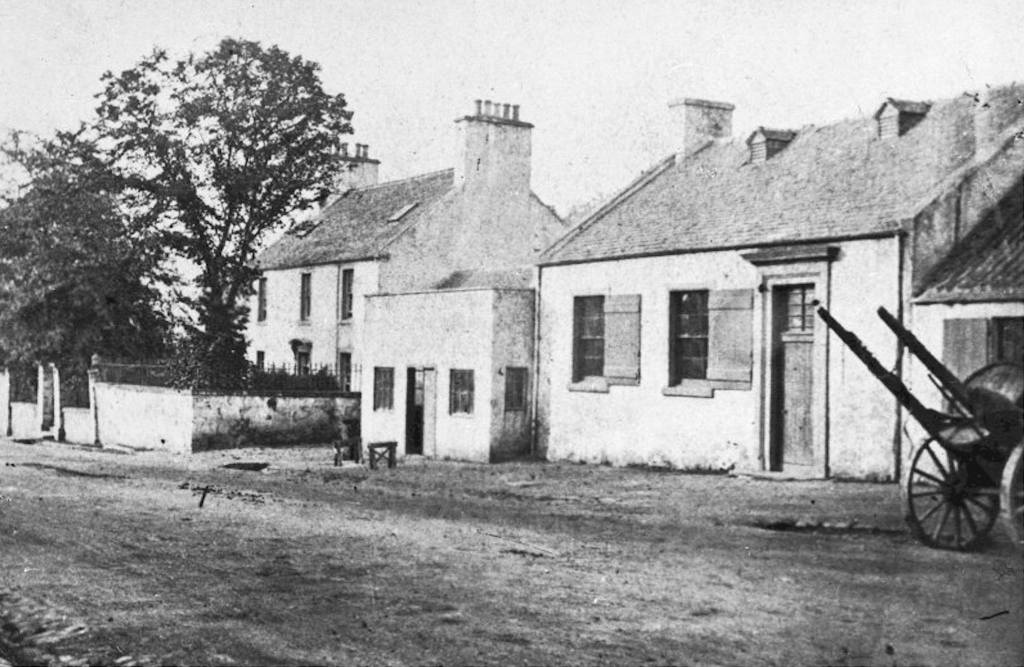
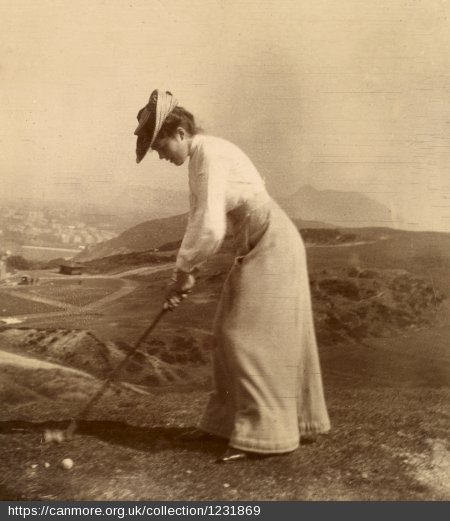
Let me end with the oldest and least relevant image. It’s not Morningside (it is halfway between the village and Edinburgh Old Town), but it’s the best representation of the area I can find from before urbanisation. I can’t resist including it!

Notes and Sources
Morningside Heritage Association is on facebook at https://www.facebook.com/morningsideheritage and also on the proper internet at https://www.morningsideheritage.org/ They have a walking Heritage Trail which you can print out at https://www.morningsideheritage.org/about-morningside/#heritage-trail
The Grange Association – http://gaedin.co.uk/ – for the nearby Grange and Marchmont areas. There is a fair bit of local history on the site, including almost a hundred pages of transcribed audio reminiscences, detailed descriptions, photographs etc. There are also some passages from ‘Braid’, by M Noreen Weston (1982) as part of a chapter on the older (mediaeval) history of the area. There is also a chronology of all maps (which I wish I had found earlier!) All free to read online.
Smith, Charles J. (1992) Morningside. John Donald Publishers Ltd., Edinburgh. ISBN 0-85976-354-4
Canmore, e.g. https://canmore.org.uk/site/52694/edinburgh-morningside-54-canaan-lane-woodburn-house
Wikipedia has a page on Sir Reginald Johnston (1874-1938). At the 60th Academy Awards, The Last Emperor won all nine Oscars for which it was nominated: Best Picture, Best Director, Best Writing, Screenplay Based on Material from Another Medium, Best Cinematography, Best Film Editing, Best Costume Design, Best Art Direction-Set Decoration, Best Music, Original Score and Best Sound – Wikipedia.
The Works of Alexander Pennecuik, Esq., of New-Hall. M.D. Containing the Description of Tweeddale, and Miscellaneous Poems published in a new edition by A. Allardice (1815) but which was originally collected and printed in 1715 can be read via Google Books, e.g. here: https://play.google.com/books/reader?id=9vBBAAAAYAAJ&hl=en_GB. It refers in the copious 1815 publisher’s notes (p 309) to the sale of Aughtyfardle in Lesmahagow (Lanarkshire) by Mr James Kennedy Esq. of Kailzie sometime previously, it seems in the 18th C., subsequent to the original, “to Hugh Mosman Esq. proprietor of the lands of Canaan, on the river Jordan, at Egypt, near Edinburgh.” The notes incorporate work by other authors from 1775 and 1802 (cf. page vii in the preface).
Gordon, J. ed. The New Statistical Account of Scotland / by the ministers of the respective parishes, under the superintendence of a committee of the Society for the Benefit of the Sons and Daughters of the Clergy. Edinburgh, Edinburgh, Vol. 1, Edinburgh: Blackwoods and Sons, 1845, p. 647. University of Edinburgh, University of Glasgow. (1999) The Statistical Accounts of Scotland online service: https://stataccscot.edina.ac.uk:443/link/nsa-vol1-p647-parish-edinburgh-edinburgh
Rev. James MacGregor (1829-1894) is the subject of a biography “James MacGregor : preacher, theologian and defender of the faith” by John W Keddie (2018). Thanks to Robin Forlonge Patterson for letting me know about this new link between my extended family (and his!) and Morningside.
Lee, Hutcheon, Dukan and Milne (2017) Rhubarb (Rheum species): the role of Edinburgh in its cultivation and development. Journal of the Royal College of Physicians of Edinburgh (47): 102–109. doi: 10.4997/JRCPe.2017.121
William Moir Bryce, The Burgh Muir of Edinburgh from the Records, The Book of the Old Edinburgh Club (1917-1918), Volume 10. One of many volumes digitised by the Internet Archive, available at The Books of the Old Edinburgh Club. Chapter 11, St. Roque’s Chapel and the Lands of Canaan, pages 167-183. Chapter 12, The Great Plague of 1585, pages 184-188.
Ordnance Survey Name Books Midlothian OS Name Books, 1852-1853 Midlothian, volume 123, OS1/11/123/6 [volume 123 (see the index) has many local place names – Canaan, Egypt, Hebron, Goshen, Jordan]. Woodburn House appears in Volume 15 page 7 – OS1/11/15/7 and Jordan Burn in Vol 15 page 3 OS1/11/15/3 Available from the website Scotland’s Places at https://scotlandsplaces.gov.uk/ which also provides many other place-linked documentation.
For an unrelated family (Aitken) who lived in the area in the late 19th and early 20th C., and a story of the history of a personal gift that they probably had to sell, only later to end up somehow in our family, see my blog on https://noisybrain.wordpress.com/2018/11/27/the-aitkens-coin-glass-goblet/
For my great aunt Ebeth, a suitable link highlighting her Morningside connection is here, and there’s also a post on the Morningside Galloway family and their links to Scottish Forestry – there was a late-in-life wedding between Ebeth and George in 1930 – I presume they met and fell in love at Greenbank Church.

fionabrownlee@btinternet.com
LikeLike
I think you will find Charles did mention D R McGregor on p221 vol 1
LikeLike
I should edit that “does not feature at all” to “one short mention” and point to my first long piece on MacGregor. But the one mention in my Morningside book is on p117… You are talking about his Historic South Edinburgh book which I had not consulted at the time of writing! There is a 1978 and a 2000 edition. A trip to the library after lockdown is required. Thanks for the note.
LikeLike
Hi Jim. I tried to add an admittedly lengthy response regarding Canaan Lane yesterday but can’t see it. I tried resending it today but got a response saying it was already there! Where am I going wrong?
LikeLike
Hi there! Sorry to be so long in replying… I have not been active with this in the last two years, so comments go into purgatory until I approve them… it cuts down on spam (not all people make sensible posts like yours). I will leave this comment for a while till I think you’ve seen it, then maybe put in the trash. Meanwhile, I will respond to your other post.
LikeLike
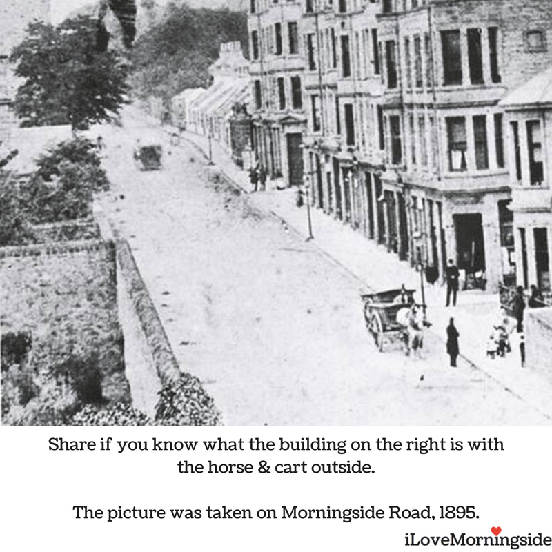
Sorry if it’s been mentioned already but i think the building with horse outside on morningside Road is the canny mans.
LikeLike
Hi there! yes, exactly right. A rather bigger four-legged animal than you would see there nowadays.
LikeLike
I must say I’ve found this a fascinating blog, not least because I think I may have a family connection to the Canaan area of Morningside!
My starting point was the marriage of my 3 x great-grandparents Robert Steel & Elizabeth Thomson in St Cuthbert’s in the centre of Edinburgh in 1832. As the 1841 census showed their eldest son was born prior to their marriage I searched for reference to this in the Kirk Session records. What I found was Elizabeth admitting in 1831 to giving birth to an illegitimate child the previous year – her address? Woodburn, Canaan!
I then searched the 1841 census for the area looking for evidence of her family – 43 households in total. I only found 1 Thomson household, in Canaan House, but they had a rather grand Edinburgh legal background whereas she was from humbler Perthshire stock. However, in this small area I found 4 Steel households, all in Canaan Lane, raising the possibility Robert had links to one of these, hence meeting Elizabeth!
Does anyone know of lists of residents in this area in the years leading up to 1832?
By the way, the daughter of one of these Steel households married James Denholm, the blacksmith whose smiddy is shown in a photo above.
Also the death certificate of one of these householders, James Steel in 1894, was notified by his niece Mina Lauchlands, a very similar name to that of one of the ancestors of our blogger James Scobbie!
LikeLiked by 1 person
How interesting! Maybe she was a servant living in a grand house… she would surely have appeared in the census though, in a household with a different surname, and you would have found her. It’s just possible she is related to the grander Thomson family, a distant relative or similar, but I expect that’s less likely, if it weren’t for the Steel connection… that does maybe raise interesting options. I suppose the social standing of your ancestors Steel+Thomson after their marriage might be the best clue to their social standing prior to it. I hope someone reading here or searching finds your comment and can add something else.
I was thinking of adding a note to one of these Morningside blogs about the entertaining if gruesome historical crime novel by ‘Ambrose Parry’ – I just read the first, and Gregory’s Powders and other Edinburgh medical history circa 1850. I think Parry, and Sara Sheridan in the ‘Fair Botanists’ set in the 1820s, and Sarah Smith’s ‘Hear no Evil’ with a deaf sign-language context are excellent fun for family historians with links to the city at that time.
Finally… indeed, Mina Laughland was the name my great grandmother Williamina or Wilhelmina. (I can’t recall for now… someone else had those forenames also and dropped the trendy German spelling in later life when that became awkward.) I think my Laughlands are all from Ayrshire, originally.
LikeLike
It was hard for me to believe at first I could even read such a lengthy article. Your writing style impressed me. As usual, you delivered outstanding content. Great Article Neil. This article is great. Even though I read it only a couple of times I didn’t make any comments. However, I thought that the article merited being mentioned.
LikeLiked by 1 person
Thank you, that’s very kind! I have had the same feeling when writing these… and indeed when re-reading my own work… the posts are full of material I then forgot about, right away! 🙂
LikeLike
Hi Jim
Have to say I’ve been a bit erratic in my involvement in tracing my family tree – over decades!!!
However now I’m retired it’s become a major interest for me.
Regarding Elizabeth Thomson, by the 1841 census she was married to Robert Steel and living in Newhaven. The reason I was seeking Thomsons in the Canaan area was in the hope of finding her parents or siblings, to 100% clinch she’s my Elizabeth. However the chances of 2 members of the same congregation having illegitimate kids within a months of each other seems pretty far-fetched, especially given the prevalence of Steels in the Canaan area at the time. As for the social standing issue, the one Thomson I found in the area, a Writer to the Signet living in Canaan House, and whose family appear to have been part of the Edinburgh Establishment for quite a while, shows no sign of connections to Perthshire where Elizabeth was born.
Turning to Gregory’s Powder, as you know Dr Thomas Steel, surgeon & chemist, for whom Steel’s Place is named, had a factory between that street and Canaan Lane manufacturing magnesia, a key ingredient in that powder. As Dr Gregory lived in Canaan Lodge I would assume supply chain issues were unheard of! Until this week I again felt due to social standing reasons he was unlikely to be linked to the humbler 4 Steel households around the corner, but I’ve just found out that in 1814 he was a witness for the marriage of another Thomas Steel, a labourer who in 1841 lived opposite where the new Canaan Lane School stands. The other 3 Steel households headed by James, David and William, were in 1841 opposite where the modern blocks called Falcon Court stand.
I mentioned a Mina Lauchland, niece to James Steel, reported his death in 1894. I could only find 2 candidates in the 1891 census:-
1) Minnie Lauchlan (13) born in Glasgow. 16 or 17 seems rather young to have responsibility for reporting a death, but I guess kids had to grow up fast in the 19th century!
2) Williamina Laughland (6) born in Stewarton, adopted daughter of Alexander & Jane Laurie. Her Stewarton birth suggests a link to your family.
On the subject of Stewarton I also have 19th century to that town, and some of the surnames in your tree coincide with mine, namely Currie, Scott & Calderwood.
It really is a small world!
Cheers
Derek
LikeLiked by 1 person
It’s a wonderful time-sink! I am already looking forward to the opportunities that retirement will bring in terms of time. This project online has lots, and lots, and lots of gaps! One of my wee goals is to find unknown connections within the family a few generations back – place, occupation, marriage… whatever. It’s hard to be sure with so many shared surnames! I suspect often there are family links. Your finding of being a witness really brings that home… some cousin or other, with high social standing, would be the guest of honour, if they were not a snob! And, some of these people made money very fast in those days. Some would be horrible snobs, and others would reach out. I guess that’s all very Jane Austen too.
The Stewarton Laughland does indeed seem to be another of those connections. It’s not a route I’ve gone down – there is a very active researcher (a 5th cousin) on geni.com
LikeLike
Since my last post I’ve discovered Dr Steel did indeed have links to the 4 humbler Steel households in Canaan Lane in 1841 – 3 of the heads of those families were his nephews, as was the father of the 4th one. They were 4 brothers all born in Walston parish in east Lanarkshire, as was Dr Steel. When he died in 1818 he bequeathed each of them £100, which is worth about
£10,635 today! Over the next few years they feued their plots of land from William Patison, who in turn had feued his land from William Mossman.
Sadly I haven’t been able so far to establish a link between my ancestor Robert Steel, for whom I don’t have a birthplace, and this family. However given that his future wife Elizabeth Thomson lived at Woodburn, probably as a domestic, in a street where almost 10% of the householders were Steels, I’m strongly inclined to think they met through some local family connection. It’s worth mentioning too that in looking at indexes of births, marriages and deaths of Steels in Scotland in the late 18th early 19th centuries, by far the biggest concentration was in the northern halves of Lanarkshire & Ayrshire, with a smaller one in south Dumfriesshire. Other than that it is scattered individuals who probably link back to these core areas. The probability is then, that wherever my Robert Steel was born, it wasn’t far from where the Canaan Steels originated in Walston, Lanarkshire!
LikeLiked by 1 person